
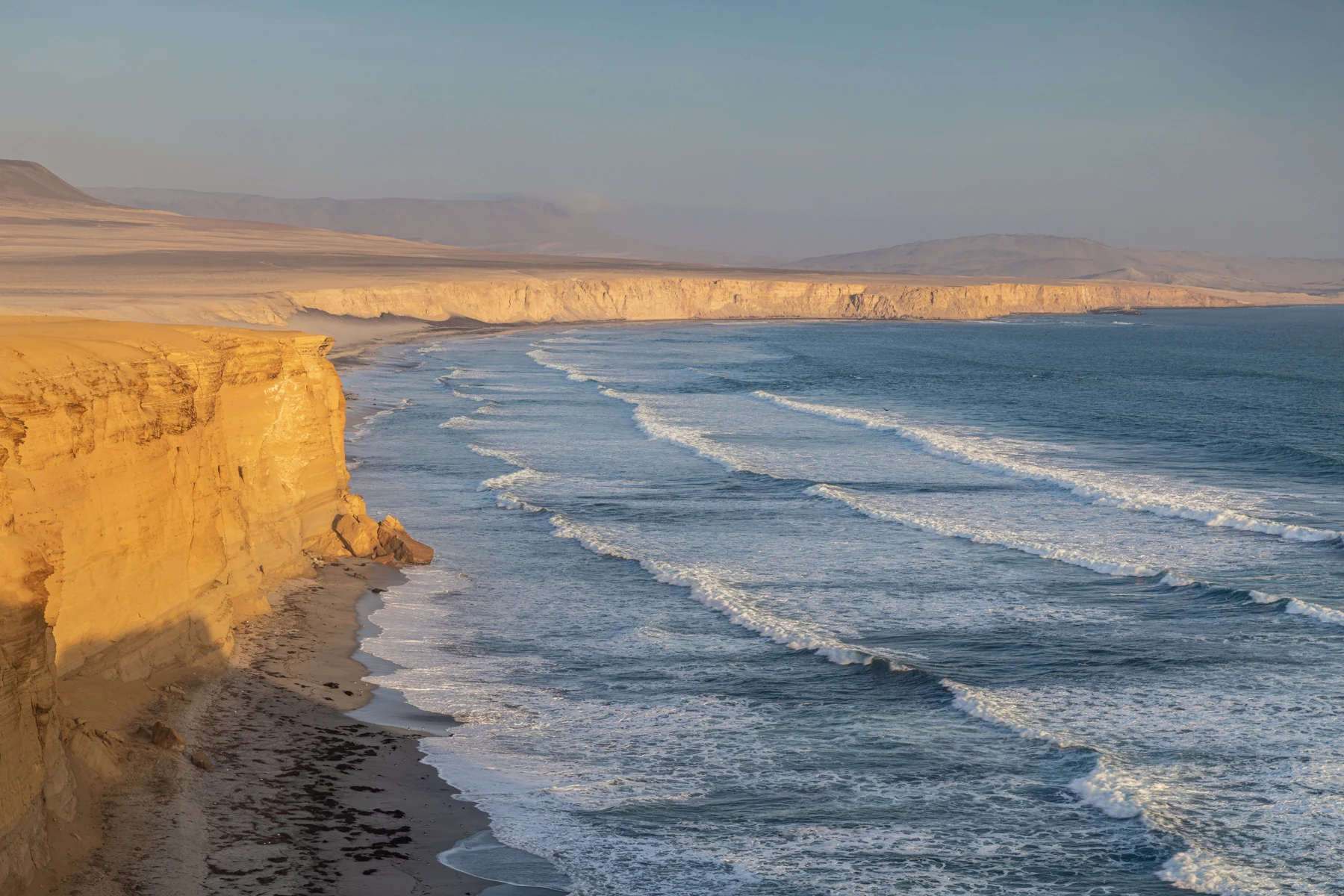
Paracas beach Peru: compare beaches and visitor access
Compare the Paracas town shore, reserve viewpoints and permitted beach stops by access, water use and return transport.

BallestasIslands.com is an independent travel guide. We are not SERNANP, a reserve authority or a tour operator.
Use El Chaco for the town waterfront, Playa Roja for a permitted landscape view, or compare La Mina and Raspón for a longer reserve beach stop. The official circuit map marks some beaches for bathing, but a map symbol is not a same-day sea or water-quality clearance. Follow current reserve instructions and arrange the return before spending time away from town.
On this page13
- Choose a Paracas beach in Peru by purpose
- Town coast and reserve beaches
- El Chaco: town waterfront rather than a reserve circuit
- Playa Roja: choose the view
- La Mina: plan the whole beach visit
- Raspón: check the approach, not just the water
- Yumaque: space and use need current advice
- Access and transport comparison
- Viewing, walking and swimming are distinct
- Facilities and environmental care
- Make the beach stop work beyond the photograph
- Continue with the related guide
- Verdict on choosing a Paracas beach in Peru
Choose a Paracas beach in Peru by the task: a town stroll, a reserve viewpoint or a bathing plan with current local advice. El Chaco, Playa Roja and Playa La Mina are not interchangeable stops. A beach can be worth seeing without being suitable for swimming. Check access, transport and facilities for the exact place you choose.
Compare the shore by purpose
A town walk, reserve viewpoint and permitted bathing stop need different plans.
Details for each option
Place: El Chaco waterfront
- Better starting purpose
- Town walk, meals and boat orientation
- Access or facility question
- Current local shore use and the supplier's actual pier
Place: Playa Roja viewpoint
- Better starting purpose
- A short landscape stop
- Access or facility question
- Which viewing place is open; do not assume sand access
Place: Playa La Mina
- Better starting purpose
- A planned reserve beach stop
- Access or facility question
- Current entry, bathing instruction and facilities
Place: Playa Raspón
- Better starting purpose
- Another beach choice within the reserve
- Access or facility question
- Access surface, steps and current services
Place: Playa Yumaque
- Better starting purpose
- A wider coastal stop on the visitor circuit
- Access or facility question
- Permitted use, conditions and return transport
Sources and limits are explained in the guide · · Table by Ballestas Islands
Choose a Paracas beach in Peru by purpose
Start by deciding what you want to do beside the water. A scenic stop may need only a viewpoint and a short walk. A family beach stay needs much more: usable access, current bathing advice, toilets, shade planning and a clear return.
SERNANP's official circuit map distinguishes named viewpoints and beach-service symbols. Checked October 2026. Use the map's categories to ask better questions, not as a guarantee that every marked service is operating today.
The reserve guide explains the mainland visit. An island boat can show coast from the water without providing a beach landing. Keep that distinction clear when comparing packages.
Town coast and reserve beaches
These are planning choices, not a quality ranking. The best beach for a photograph may be the wrong one for a long stay with young children. Ask about the actual task rather than choosing from a colour or name.
El Chaco: town waterfront rather than a reserve circuit
El Chaco is useful when you want to stay near town services. It is also part of the boat-departure setting. A walk and a meal here can fit a boat-focused stop without adding a land circuit.
Do not confuse the promenade with the whole reserve. A visitor can spend time by the town water without seeing the mainland viewpoints. Equally, a reserve tour can finish without giving you a long town break.
For a boat, get the specific office and pier. A broad beach pin is not a meeting instruction. Keep bags, check-in and boarding clear before deciding how much time remains for a walk.
Bathing needs its own local answer. Do not infer permission or water quality from other people entering the sea. Follow signs and the responsible authority's current instruction for the stretch you are using.
Playa Roja: choose the view
Playa Roja is a strong landscape choice when you want the contrast of the red-toned shore, water and desert. The official circuit identifies a viewpoint. Plan that use rather than assuming a path onto every part of the sand.
Ask where the vehicle stops and how you reach the permitted view. Keep behind barriers and away from cliff edges. A dramatic crop in a photograph may hide the safe position from which it was taken.
Do not add a swim because the stop has “beach” in its name. This guide does not recommend Playa Roja as a bathing plan. A short view can still be a satisfying part of the circuit.
For a group, agree what everyone is doing at the stop. People should not wander toward the shore while the driver expects a brief viewpoint pause. A clear meeting and return time prevents a scenic stop becoming a search.
La Mina: plan the whole beach visit
Playa La Mina needs more planning if you want time on the beach. The official circuit map marks bathing and visitor-service symbols there. Those symbols describe the map, not a live guarantee of sea conditions or staffed facilities.
Ask reserve staff what is permitted now. Check the access surface, any steps and how far you carry bags from the vehicle. A photo taken at sand level cannot show the demands of reaching it.
If you hope to swim, ask about the day's conditions and local instructions. No old brochure or calm-looking photograph can certify the sea for your group. Children and less confident swimmers need a plan that does not depend on assumptions about depth or supervision.
Arrange pickup before settling in. A vehicle dropping you off is not automatically waiting, and an app may not solve every return from a reserve stop. Agree the place, time and delay procedure with the actual provider.
Raspón: check the approach, not just the water
Raspón is another named reserve beach on the official circuit. Compare it with La Mina by the current approach and the facilities your group needs. Do not assume nearby beaches have identical access.
Ask about steps, uneven ground and the route from parking. A person who can manage a short flat walk may still find a steep approach difficult. Give a provider the specific need rather than asking only whether the beach is “easy.”
The map marks visitor services at the beach, but operating details need confirmation. Carry the water and essentials you need even when a snack symbol appears on a map. Check toilets before making a long stop depend on them.
If the approach or conditions do not suit, choose another stop. A beach day should not begin with pressure to continue because the group has already arrived. Keep a smaller coastal view as a practical alternative.
Yumaque: space and use need current advice
Yumaque is included in the official northern circuit. It can be part of a wider reserve route rather than a separate destination reached from town. Ask what the tour actually does there and how long the stop allows.
Do not read every historic activity listed in an old brochure as current permission. Camping, fishing and water use can have distinct rules. A visitor map is not a licence for all three.
For a longer stay, ask about shade, toilets and the return. An open coastal setting may need more preparation than a town beach with services close by. Keep loose items and packaging secured against wind.
Choose it for the visit you can support with clear information. If the only answer is that a previous group went there, ask for the current instruction. Past use is not the same as today's access.
Access and transport comparison
For an organised circuit, ask which beaches are viewing stops and which allow time on the sand. The difference matters when choosing clothes, bags and expectations. A short photo pause cannot be stretched into a long swim without changing the group plan.
For independent transport, arrange the whole visit and return. Check whether the vehicle may use the intended roads. A taxi receipt or rental agreement is not a reserve permit.
Use the reserve map for the named places and then follow current instructions. Do not take a shortcut over bare ground because a phone map draws a line. Protecting the landscape applies between the stops too.
If a beach is closed or conditions change, choose another permitted activity. Do not pressure the driver to find an unofficial approach. A land visit can still be worthwhile without entering the water.
Viewing, walking and swimming are distinct
Permission to reach a viewpoint does not mean permission to descend to the beach. Permission to stand on sand does not establish suitable sea conditions. Keep each question separate when asking staff.
For a swim, use current local advice for that place and day. Check any flags or instructions and do not assume lifeguards are present. This guide does not offer a water-safety certification for any beach.
For a walk, stay on permitted surfaces and keep away from unstable edges. A low tide view in a photograph can look like a path that is not usable later. Do not plan a return around an old image of the shore.
For a photo, choose a safe permitted position. A wider frame can show the coast without crossing a barrier for a closer crop. The view does not improve enough to justify ignoring an access instruction.
Facilities and environmental care
Ask about toilets, food and drinking water at the exact stop. A facility symbol can be useful without proving current opening. Carry essentials and keep a shorter visit as an option if a needed service is unavailable.
Take rubbish out and leave wildlife alone. Do not feed birds, collect animals or move natural objects to stage a photograph. Keep children within the group's permitted area.
Avoid taking a pet into the reserve without checking the rule. The official visitor information is the starting authority route. Checked October 2026. Current staff instructions govern the actual visit.
Make the beach stop work beyond the photograph
For a brief circuit, choose a view stop and leave it as that. Tell the driver you want time to look without a long shore break. This can make the route clearer for a group whose main interest is the coast rather than swimming.
For a longer beach stay, ask about the path from parking to the shore. Sand and slopes can change what is practical with children, bags or a mobility need. Ask for the actual route rather than a general “easy access” label. A short distance can still be hard to cross.
Check where you can use a toilet and whether a food stop is part of the plan. A symbol on an official map gives useful context, but a facility may not be operating when you visit. Carry the basics you need instead of relying on every marked service.
Arrange shade and sun protection in a way allowed at the site. Ask staff if you are unsure what may be set up. Keep paths clear, take all waste out and leave natural material where it belongs. The shore is part of a protected place as well as a visitor stop.
Agree on the return while still in town
Tell the driver how much time you want ashore and what would make you leave early. Ask where the vehicle waits and how you can contact it. A vague promise that you will “find a ride back” is a weak plan away from the town.
If conditions rule out the main activity, decide what the group would prefer. A view, the museum if open, or a meal can each be a useful alternative. Agree on any price change before setting out. That gives the day room to adapt without turning a closed beach into a dispute.
Keep a fixed onward departure out of the beach's last possible minutes. Allow time to return, change if needed and collect bags. A calm finish is part of a good shore visit, not time lost from it.
Continue with the related guide
Verdict on choosing a Paracas beach in Peru
Choose a Paracas beach in Peru by what you want to do and the conditions you can confirm. Keep El Chaco, Playa Roja and a longer La Mina or Raspón stop distinct. Compare a local excursion only after checking whether its beach time matches your plan, with a clear way back to town.