
How was Huacachina formed? Science, legend and water management
Understand Huacachina's groundwater origin, the lagoon legends and the limits of historical water-management accounts.

BallestasIslands.com is an independent travel guide. We are not SERNANP, a reserve authority or a tour operator.
The science explanation is groundwater reaching a low point in the sand. Plants grew around that water. Dunes surround the basin. Legends give the lagoon a distinct kind of story. Modern additions of water do not erase its natural origin. They do mean that an old account cannot tell us exactly how the lagoon is supplied today.
On this page7
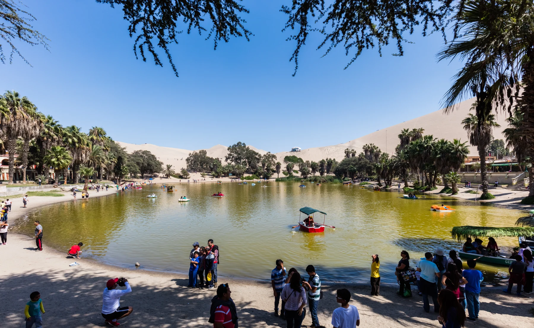
Huacachina formed where groundwater reached the surface in a hollow among desert dunes. The water supported plants around the lagoon, creating an oasis. The mermaid stories explain the place through folklore, not geology. It began as a natural oasis. Later work to keep water in it is a distinct part of the story.
Compare the practical choices
Compare each option by the details below. Confirm dated terms before making a booking.
Details for each option
Account: Groundwater explanation
- What it helps explain
- How water can collect in a desert hollow
- What it cannot show
- Today's complete water balance
Account: Local legend
- What it helps explain
- The cultural story attached to the lagoon
- What it cannot show
- The physical source of the water
Account: Modern monitoring
- What it helps explain
- Conditions measured on a stated date
- What it cannot show
- Conditions on every later visit
Sources and limits are explained in the guide · · Table by Ballestas Islands
How was Huacachina formed?
Water can be present below dry ground even where the surface looks bare. An aquifer is a layer underground that holds and carries water. Water can reach the surface at a low point. It can then form a pool. Plants grow beside the water, where the ground is less dry.
NASA Earth Observatory's 2020 account explains that process at Huacachina. It also presents satellite imagery that places the lagoon beside Ica and the dune field. Look at the water and its rim. The town sits there, with sand all around it.
Think of the oasis as a small wet place within a much drier landscape. It is not a river mouth or a sea inlet. You do not need to imagine an underground lake with a wide open channel beneath it. Groundwater can move through spaces in rock or sediment.
Groundwater and dunes do distinct jobs
The basin holds the lagoon; the dunes are the surrounding landform. Wind can move loose sand and shape dunes. A dune view helps you understand the setting. It does not reveal the depth, flow or quality of the groundwater beneath your feet.
The distinction also helps with maps. A satellite image records surface features at a given time. It can show the lagoon and nearby buildings. It cannot measure all the water below the ground. Nor can it show that the supply stays the same.
For the broader setting, return to the Huacachina Oasis guide. See it from the shore first. A permitted view from above can then show how small it is.
What the lagoon's legend explains
Huacachina has stories about a woman, a lost love and a mermaid. Versions differ. PROMPERÚ's account presents the legend as part of the place's story. Treat it as folklore when telling it to children or using it in a photo caption.
A story about tears or a broken mirror is not a competing scientific explanation. It can still have cultural value without being used as proof for the lagoon's origin. Keep the two kinds of account clearly labelled.
Modern water management needs dated proof
NASA's account also explains water-level pressure and outside additions of water. Those statements concern the situation discussed in that historical article. They are not live measurements of the lagoon in October 2026.
The National Water Authority monitoring record provides another dated source for the lagoon. Its existence is useful proof that water conditions have been studied. It should not be quoted as a current clearance for swimming.
For facts on pumping now, ask for a recent local report. Check its source and date. Avoid precise claims about how much water is natural today unless the proof measures that question. A natural origin and later human management can both be true.
What the proof leaves open
This explanation does not give a current water depth, rate of groundwater flow or bathing-water check. None can be read from a landscape photo. The swimming guide explains why those limits matter before entering the water.
Protect the edge when visiting. A closer view does not justify stepping through plants or entering a closed area. The shore and permitted visitor routes provide the context needed to understand the oasis.
Continue with the related guide
Verdict on how Huacachina was formed
How was Huacachina formed? Groundwater collected in a low place among dunes. Keep that physical process distinct from folklore and from modern water management. Enjoy the story and the landscape. Use a current local source to decide about water use or a guided dune visit.